Apr
25
Research Matters Article features our LidarCSNet framework
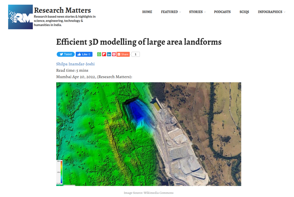
Lidar is a technique that uses light pulses to gather information about land features which can be used to create a three-dimensional representation. A device installed on helicopters, drones, or tripods sends light pulses to the land and receives reflected signals from the ground under scrutiny. Depending on the time delay between the received and sent pulse signals, the number of reflections, and the intensity of reflected light pulses, a 3D representation of the region can be created. The lidar Read more