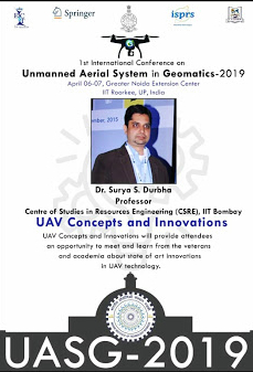
Plenary Talk Chair: UAV Concepts and Innovations in UASG 2019

Dr. Surya S Durbha, our group leader was invited to be a chair for the plenary talk on the theme UAV Concepts and Innovations at the 1st International Conference On Unmanned Aerial System in Geomatics – 2019. The conference was organised in cooperation with the International Society for Photogrammetry and Remote Sensing (ISPRS). The talk was conducted on the 7th of April 2019 at the IIT Roorkee Noida Campus.

Acing the Build-a-thon at the Google Earth Engine India Advanced Summit

Our Ph.D. students – Abhishek Potnis and Rajat Shinde were selected to attend the Google Earth Engine India Advanced Summit by Google India in Bangalore. They were selected as one of the best teams for the Build-a-thon that took place during the summit. It was a two-day event where teams were expected to work on their problem statement using Google Earth Engine. The team consisting of our Ph.D students – Rajat Shinde and Abhishek Potnis worked on “Locating Solar Farms Read more

SIIM Framework Featured in Research Matters Article

Satellite images are a rich source of data and can play a significant role during a disaster scenario in planning and mitigation activities. The images captured here contain low-level features like colour, texture and shape, which are understood by the system, but hardly make sense for the user. For example, a user may be interested in a search for ‘flooded residential areas’. Since the images capture the flooded areas with a different colour or texture, the system fails to understand Read more

Exhibits at World Congress on Disaster Management

The 4th World Congress on Disaster Management was held at IIT Bombay during 29th January – 1st February 2019.It was organized jointly by the Government of Maharashtra (India), Disaster Management Initiatives and Convergence Society (DMICS), Indian Institute of Technology (IIT) Bombay and Tata Institute of Social Sciences (TISS), and was designed to be the largest assembly on disaster management outside the UN system and had a plethora of exhibits related to rapid response in the wake of a disaster. Geocomputational Read more

Team wins Esri India’s mApp Your Way 4.0

A team from Centre of Studies in Resources Engineering mentored by Prof. Surya S Durbha secured the first Runner Up position in the mApp Your Way 4.0 App Development Challenge held at Indian Institute of Technology Delhi, New Delhi on January 8, 2019. The team of students comprising of Gaganpreet Singh, Sandeepan Dhoundiyal, Nidhi Kapoor, and, Aditya Vitthalrao Chondke developed a GIS based mobile and web application to address the issue of Logistics and Supply Chain Management. Congratulations to the Read more

Media Coverage at TechFest 2018 for Pothole Mapper

Ongoing research on mapping and monitoring of potholes presented at the TechFest 2018, IIT Bombay was covered by numerous print and video news media outlets. The primary objective of this research is to develop a Location Based Service(LBS) using Smartphone based Crowd-Sourcing application for: mapping and monitoring of potholes and pothole-free routing. Midday – A popular English newspaper covered the Pothole Mapper application in an article(https://www.mid-day.com/articles/mumbai-iit-bs-annual-tech-fest-to-display-human-like-robots-solar-powered-chai-stall-and-more/402059). Below is an excerpt from Lokmat – a local Marathi newspaper covering the exhibit. Read more